Reading a landscape
Every section layout, drawn once
A working preview of the page vocabulary — fifteen layouts with real content.
Reading a landscape
Every layout in the page vocabulary, drawn once, so the design can be judged before anything depends on generating it.
This page exists to be looked at. It uses real content from the programme rather than placeholder text, because a layout that holds lorem ipsum well can still fall apart the moment a Hawaiian plant name or a three-line caption arrives.
What you are looking at
Fifteen section layouts make up the vocabulary a generated page is composed from. The model never writes markup — it chooses a layout and fills that layout’s slots, and this renderer decides how a slot is drawn.
That constraint is what makes a generated page safe to publish. There is no arrangement reachable from the vocabulary that produces something broken, so the failure mode shifts from "ugly" to "a choice you would have made differently" — and that is a swap, not a repair.
Moisture zones
Hawaiʻi’s seven moisture zones run from arid leeward coast to very wet windward upland. They were mapped by Price, Jacobi and colleagues in 2012 and they underpin almost everything the programme does: where fire carries, which seed will establish, where intact forest survives.
This is a split section. The image takes five columns and the text seven — an even split reads as a diagram, an uneven one reads as a page.
Seed collected in a dry zone rarely establishes in a wet one.
Why moisture zones function as seed transfer zones
Collect to the zone
Matching a collection to its planting ground is the difference between a nursery that works and one that quietly wastes a season. The same species behaves differently across the gradient, and provenance travels with the seed.
This is the mirrored split. Alternating them gives a long page rhythm without introducing a new layout.
The gradient in numbers
- 7
- Moisture zones, arid to very wet
- 16,660
- Square kilometres mapped
- 2012
- Price and Jacobi, USGS OFR 2012-1192

Three constraints
Schema
An unknown layout or a missing required slot is rejected before it reaches a page. The model cannot invent a layout name.
Budgets
Every text slot has a character range. A pull quote over 180 characters stops being a pull quote, so the schema refuses it and a different layout gets chosen.
Adjacency
No two full-bleeds in a row, no hero out of first position, no three heavy sections stacked. Rules in code, not suggestions in a prompt.
Poster wall
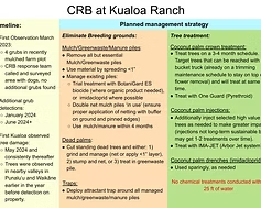
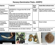
Gallery arrangement follows the count — two side by side, three as a triptych, four or more as a grid. Forcing eight images through a two-up rule is how a gallery ends up looking like an accident.


Moisture zones
A table section holds data transcribed from a source. This one is real.
| Zone | Name | Area km² |
|---|---|---|
| 1 | Arid | 1999 |
| 2 | Very Dry | 3086 |
| 3 | Moderately Dry | 2460 |
| 4 | Seasonal Mesic | 2912 |
| 5 | Moist Mesic | 1904 |
| 6 | Moderately Wet | 2822 |
| 7 | Very Wet | 1478 |
Areas sum to roughly 16,660 km² — essentially Hawaiʻi’s land area, which is how we know the dissolve dropped nothing.
Native species
This section stores a query, not rows. It resolves every time the page renders, so it cannot go stale the way a pasted list does.
- Metrosideros polymorpha
- Acacia koa
- Vaccinium reticulatum
- Argyroxiphium sandwicense
- Cibotium glaucum
- Sophora chrysophylla
- Jacquemontia sandwicensis
- Myoporum sandwicense
- Sadleria cyatheoides
- Dubautia menziesii
- Pipturus albidus
- Vaccinium calycinum
Live from this node’s species · endemic species
Who to ask
A contact section closes a page. It takes up to six people and reflows to one column on a phone.